


River Heights
Last Updated: Tuesday May 12th, 2026 09:32 PM CDT
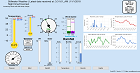
| Stage Color Key | |||||
|---|---|---|---|---|---|
| No Flooding | Near Flood | Minor Flooding | Mod Flooding | Major Flooding | Obs > 24hrs |
| Flood category not defined | At/Below low water threshold | Out of Service | |||
| Marker Key | |||||
 Forecast Available Forecast Available |
 Probability & Forecast Available Probability & Forecast Available |
 Observations Only Observations Only |
|||
Data Courtesy of the National Water Prediction Service
Script Courtesy of Dennis at East Masonville Weather
with mods by Saratoga-weather.org